


Too coarse
High-level nature scores
Useful for initial orientation, but often too broad for decisions about a specific place.
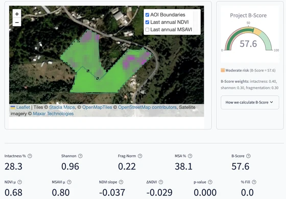
Upload a site boundary and receive a structured Evidence Pack combining environmental context, land-cover composition and change, annual satellite composites, vegetation time series, landscape metrics and VerdeSat's transparent B-Score.
Land boundary in - decision-ready nature evidence out
Built for faster screening, monitoring and reporting workflows across consultancies, restoration projects and site-based sustainability teams.
Organisations increasingly need to understand how forests, farms, restoration projects, supplier locations and land investments interact with nature. But evidence for a specific location still depends heavily on fragmented datasets, specialist GIS work and custom reporting.
Most teams choose between scores that are too coarse and assessments that are too slow. VerdeSat provides the practical first layer between those two extremes.
Useful for initial orientation, but often too broad for decisions about a specific place.
More detailed, but difficult to repeat across many locations, customers or reporting cycles.
Upload the boundary of a forest, farm, restoration project or other area you need to assess.
VerdeSat processes satellite imagery, land-cover information and relevant contextual data through its analytics platform.
Review the AI summary and recommendations, maps, metric breakdowns, vegetation history, methods, limitations and data lineage.
Compare sites, identify potential concerns, monitor change, brief a consultant or decide where deeper investigation is justified.
VerdeSat translates complex geospatial data into outputs that non-GIS teams can review, compare and reuse.
Country, administrative region, climate zone, ecoregion, biome and source-specific sensitive-area context such as distance to Protected Areas where applicable.
Mapped composition, dominant classes, historical snapshots, change between observation years and land-cover history visualisation.
Annual satellite composites plus vegetation time series and annual signals, including NDVI and MSAVI in the standard report.
A transparent 0–100 screening summary built from natural land-cover intactness, land-cover heterogeneity and fragmentation condition.
A downloadable customer-facing report combining maps, metrics, contextual evidence, selected reporting-framework mapping, methods and provenance.
Structured evidence and lineage outputs for further analysis, QA and downstream integration alongside the human-readable report.
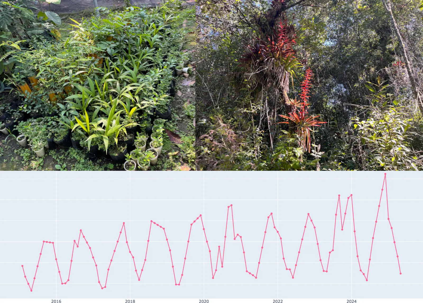
Contextual layers such as Protected Areas, ecoregion, biome, and Mean Species Abundance are included where relevant to the site.
VerdeSat exists to make nature evidence cheap enough and fast enough to be used routinely — because decisions about land are made whether or not the evidence arrives in time.
Sites that would never justify a bespoke GIS project now get a consistent nature assessment, widening the share of land under observation.
Vegetation and land-cover change is tracked across reporting periods, so restoration effort and funding follow evidence rather than assumption.
Comparable indicators arrive before capital is committed, moving nature from a late-stage check to an input in the decision itself.
Automating first-pass screening frees ecologists and GIS specialists for interpretation, fieldwork and recommendations.
VerdeSat combines satellite-derived vegetation dynamics with land-cover structure and contextual geospatial information.
Every report carries its data sources, indicator definitions, method information and lineage, so results can be checked, defended and reused.
Sentinel-2 vegetation observations, annual land-cover data, Natural Earth location context, Köppen–Geiger climate, RESOLVE ecoregions and source-specific contextual data.
A reproducible screening summary with explicit component definitions for land-cover intactness, heterogeneity and fragmentation condition.
Site evidence can be mapped to selected parts of ESRS E4, GRI 101 and TNFD LEAP to support downstream reporting and review workflows.
Land boundary in, structured Evidence Pack out.
Location, environmental context, land-cover history, vegetation signals, landscape metrics and the B-Score are assembled in one workflow.
Methods, source versions, provenance and machine-readable evidence travel with the report so results can be reviewed and reused.
The Evidence Pack is generated from a shared Earth-observation and geospatial analytics platform rather than a one-off reporting script.
A consistent site evidence contract creates the foundation for longitudinal monitoring, standards-mapped workflows and portfolio-scale products.
VerdeSat was founded by Andy Dara, a remote-sensing scientist and a co-founder of CarbonSpace.
During his PhD in remote sensing and land-cover change at Humboldt University of Berlin, Andy worked on turning complex satellite observations into usable environmental evidence. At CarbonSpace, he later helped build satellite analytics for carbon fluxes in agriculture and forestry.
Customers repeatedly asked whether similar technology could also support biodiversity decisions. VerdeSat was created to turn that recurring demand into a focused, operational product.
“The problem is not a lack of environmental data. It is turning fragmented data and specialist workflows into evidence that decision-makers can actually use.”
Companies, investors and restoration projects increasingly need fast, comparable evidence for forests, farms and other land assets. VerdeSat already automates the first step: upload a boundary and receive a decision-ready Evidence Pack in minutes.
The product roadmap extends this working platform into recurring monitoring, portfolio screening and API integrations—creating a scalable software and data business.
VerdeSat is opening conversations with founder-friendly pre-seed investors, strategic partners and non-dilutive funding programmes supporting biodiversity, Earth observation and climate technology.
Request a pilot, explore a consultancy partnership, discuss a restoration-monitoring need or ask for the investor brief.